|
2020 PAINTING LOCATIONS - LOS ALAMOS
Plan your painting trip here.
This page is accessible only to the Paint Out & Show Participants..
On the phone, log into this PAPNM site, choose the 3 bar menu and scroll down to this Painting Locations’ page; then it might be better to turn the phone on the side. Click on the direction links. (Choose Your location if appropriate, after x'ing out the starting location). The text directions on this page are perfectly adequate for printing in advance. I just like to use my phone's GPS now when I am driving around. I may even enter locations on my car GPS in advance.
Some location images can be enlarged (hover hand will appear).
Print this page in a few ways: place your mouse on the page and then select the browser printer, usually on the top bar. Or select this pdf version: PAPNM - 2020 Painting Locations.pdf
The underlined directions are generally google map directions.
Note the underlined blue links to (google map) directions and websites for some of the locations. They are NOT accessible out of cellular range. Recommend that you study the directions - or print them ahead of time. The google map starting point may vary. You may substitute in your desired starting point. In any case, the directions give you an idea of how to find the place once in the Los Alamos area.
Location | Directions | Overview | Parking/Facilities |

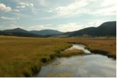
Anderson Overlook directions | Overlook is small with traffic going by. | Parking: about 4 vehicles |

Drive 502 towards Los Alamos up from Anderson Overlook. It is dangerous to try to access the Anniversary Trail from below. If people are coming up the hill from below, they should continue past the pull off for the Anniversary Trail to the industrial park on the right (north) side of the highway, turn in there and head back down to the pull off for the Anniversary Trail. The industrial park is only another quarter mile up the road, so not a big detour. At the top of the hill there is a large gravel area on the left, unmarked. The trail is off the side of the lot (scroll to the right on the map a little) | Anniversary Trail is higher than Anderson Overlook with fabulous views and plenty of room to spread out. Very little if any shade. Also: 1/4 mile hiking trail along the mesa top offers the same views as the overlook with more choices and fewer onlookers. | Parking: about 5 vehicles Facilities: nearby at Canyon Rim Trailhead just up the road and the Front Gate Memorial: Sign up: 6 people |

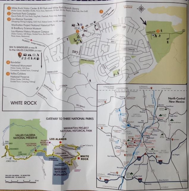
White Rock Overlook_directions
| You can get out of your car, walk about 25 feet and set up right there, or explore other areas nearby. Also: Gigantic views of White Rock Canyon. Picnic area with awnings over tables. A great hang out spot. |

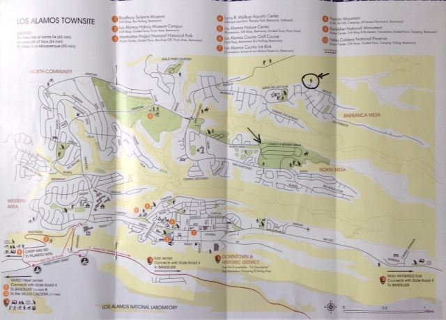
4 Canyon Rim Trailhead |
| Overlooks with wide paved trail. Somewhat of a steep grade to get off the trail to paint. Can paint from parking lot area as well. |
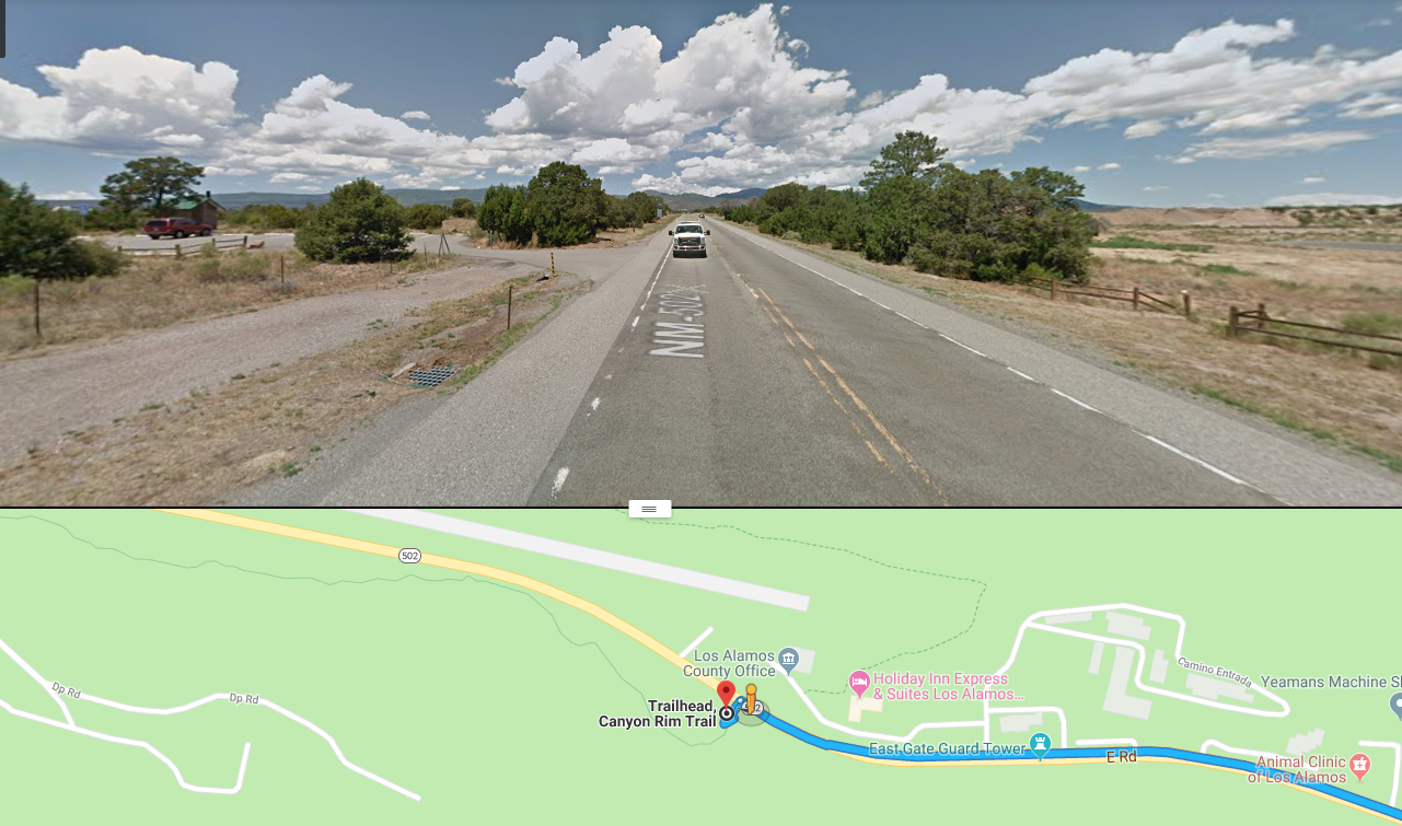
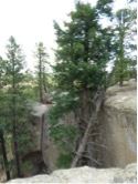
Follow US 285 N to NM502. Follow NM 502 to Los Alamos. After you are in town there is a split where 502 curves to the left and Central goes straight. Take Central Ave past Ashley Pond. Turn right into the Aquatic Center Parking lot on the right. The trailhead is just left of the entrance to the Aquatic Center | Pueblo Canyon is a deep gash in the Pajarito Plateau that runs through the center of Los Alamos. Trails follow the canyon bottom and the south rim, but the north rim is a shear wall of orange volcanic tuff, spewed as ash from the Valles caldera about one million years ago. The rim offers stunning views of the canyon and the mountains of northern New Mexico. Within the canyon are clusters of tent rocks created from dense rocks capping spires of tuff. | Parking: yes
|

7 Valles Caldera |
from Albuquerque: 1. Take I-25 North and Exit on to Highway 550 (Farmington Highway - old Hwy 44). 2. In San Ysidro, take Hwy 4 to Jemez Pueblo and Jemez Springs. 3. Follow Highway 4 at fork at La Cueva (stay right). From Los Alamos: 1.Take Trinity Drive to Diamond. Take a left on Diamond, then a right on Jemez Road to the intersection with State Highway 4 4. Take a right [away from Bandelier National Monument], following the highway up and into the Jemez Mountains.) 5. The Preserve is 18 miles up Highway 4 from Los Alamos. | The Valles Caldera National Preserve is the remnants of a million-year-old eruption. Hidden beyond Los Alamos in the New Mexico Jemez Mountain Range, the 89,000-acre preserve is a secret garden enclosed by a geologic wonder. It has a beautiful and wonderful view of the geological caldera vista containing wildlife, elk herds, trout streams, and even old movie set. Open 9 - 5. $25 per car unless you have National Parks pass, then it is free | Parking: yes |
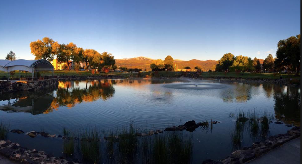
Follow NM 502 to Los Alamos. After you are in town there is a traffic circle. Take the Central Ave. exit. Ashley Pond is on your left. | Large pond in middle of town with lots of flowers, water vegetation, fountain, and greenery. Some shade Also sculpture throughout the area. Farmers Market will be there on Saturday morning. | Parking: yes off 20th street by stage |
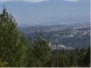
9 Pajarito Ski Area/Camp May | Pajarito Ski Area Directions | Do not paint here alone as it is very isolated. Views overlook Los Alamos downtown and the canyons. There are views of the ski hill from Camp May | Parking: yes |
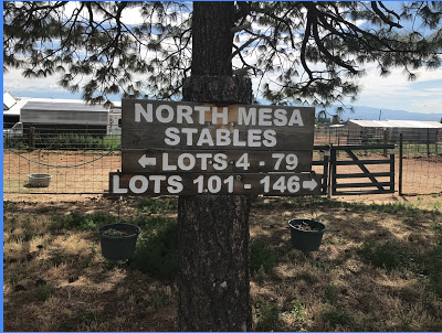
10 North Mesa Stable and Arena | 650 N Mesa Rd, Los Alamos, NM 87544 From Los Alamos, take Trinity or Central to Diamond Drive. Turn right on Diamond Drive. At the roundabout take the second exit to North Mesa Drive. The stables begin at the end of North Mesa Drive. | Horse barns and fences and a cool assortment of creatures. Great big views of the sky, so a good place for painting clouds if you continue east along the mesa from the arena on the east end of the stables. East along the mesa from the stables is nice too, Pinon and junipers, alternating bands of light and shadow in the evening with mountain backdrops. | Parking: Yes. Facilities: Restrooms on rodeo grounds and at the north Mesa Picnic area 1/4 mile before the stable and arena. |
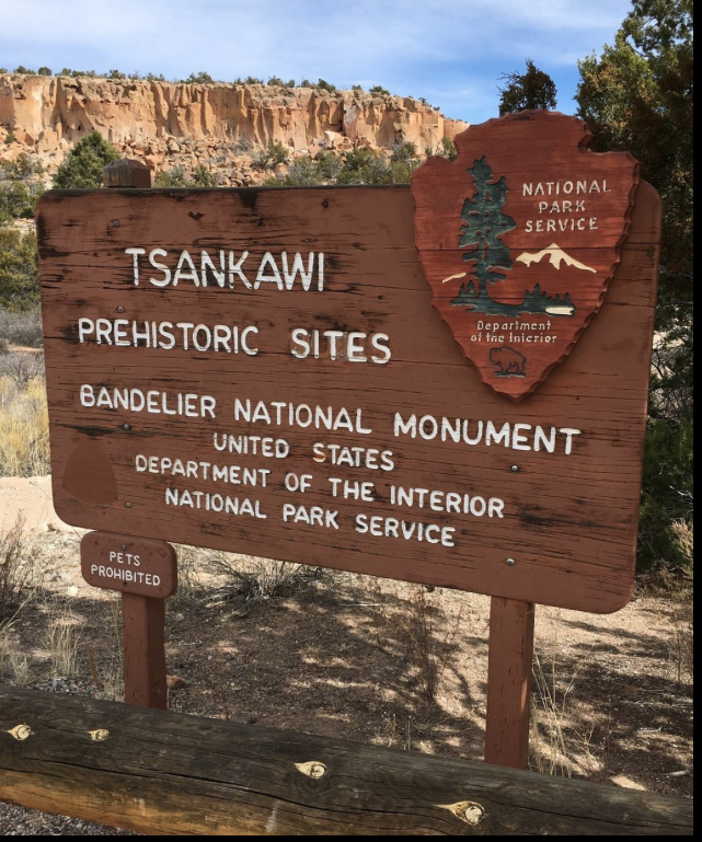
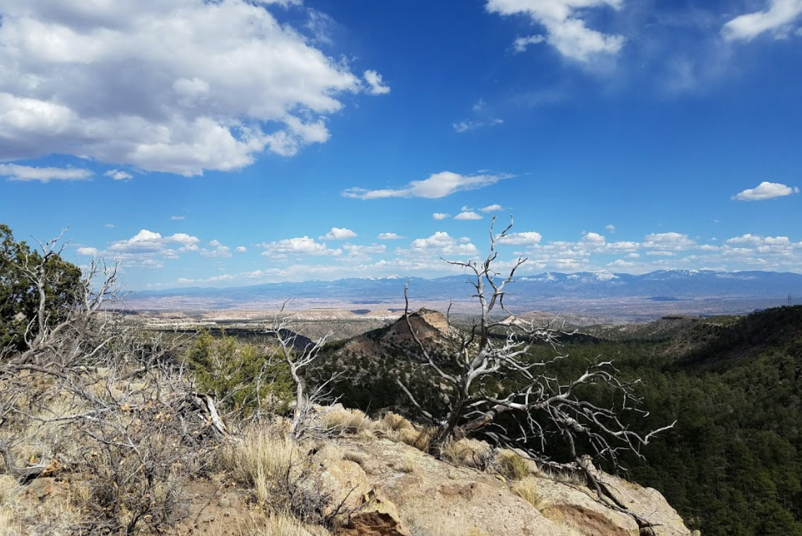
On the east side of NM 4 right next to traffic light for the intersection of NM 4 with East Jemez Road (the truck route to Los Alamos). Or come down from Los Alamos on the Truck Route. Unfortunately, Tsankawi is not the easiest place to find. Coming from Santa Fe you'll turn from State Highway 502 to State Highway 4. Less than 1/4 of a mile past this turn Tsankawi will be located on the left hand side of the road. There are no signs for Tsankawi on Highway 4. If you get to the stoplight, you've gone too far. A large gravel parking area adjacent to the highway and a sign on the fence will indicate you've found the place. Coming from Bandelier, Tsankawi is much easier to find. Just past the 3rd stoplight, the gravel parking lot for Tsankawi will be on your right-hand side. | 1.5 mile loop trail with amazing views throughout, junipers, cliffs, mesas, mountains. Great views right from the trailhead. Water and Restrooms. Part of Bandelier NM so fees apply. The trail gets lots of use, so expect lots of passersby. | Parking: yes |
Deer Trap Mesa_directions | Great views north and east right from the trailhead. Cliffs and junipers for the foreground with big views to the east. A 4 mile loop trail tours all the lobes of the mesa with amazing views all along it. |
Drive 502 to Los Alamos. Take the second right after the road to the Los Alamos Airport into the parking lot of the Animal Rescue Center. East Park shares this parking lot. The trail (also called the LifeTrail) is along a paved path behind East Park and the dog runs. | Mesa Trail is a paved trail, shady in the morning, with views into and across Pueblo Canyon to houses on top of the opposite mesa.. It is about a 1/4 mile long with lots of openings in the trees for canyon views. There are benches along the trail as well. A comfortable place to set up. | Parking: yes plenty of parking. Facilities: yes in east park Sign up? yes 6 people |

14. Rendija Canyon
|
| Advise you do not paint here alone. There is a ponderosa grove by the parking lot. The walk into the canyon is downhill for 1/10 of a mile. Going down the canyon a short way gives the best views. Up canyon is level and sandy. Rendija Canyon is not deep at this site, but there are steep canyon walls, interesting rock and trees. |

Historical Sites | General's Car outside the Hans Bethe House Victory Garden behind the Hans Bethe House Romero Cabin Oppenheimer House (This was recently turned over to the Historical Society, so this is the first time that the public has really been allowed near it! You are free to set up inside the fence.) United Church - This was the original army church that General Groves had moved to Los Alamos during WWII. Fuller Lodge (of course) | Los Alamos Historical Society is welcoming us to paint at their locations! See map included with packet for locations | Parking: varies Facilities: no |
You can go through the LANL checkpoints with a driver’s license.